MAP LANKA GEOSPATIAL TECHNOLOGY AND SOLUTIONS
“We’re approaching geographical environments from different directions, and (finding) ways of presenting geospatial locations that aren’t maps in the traditional sense, but rather map-like visualizations. It’s no longer just about a spatial display, although that remains the main reference point for any cartographer. Maps are getting smarter, and showing us the world under different parameters.” The development of a country can only take place if there is a more formal planning process. Our main objective is to establish the necessary technical services in the country. Our main tasks are to improve the human resources required to introduce more accurate technology instead of the traditional mapping process and to develop accurate and up-to-date information systems for decision making and knowledge creation. We are providing most effective service for you to get your job done. Applications in the Geographic Information System in Sri Lanka are limited to the study process. We are always at the forefront of providing you with the most advanced and efficient methodology currently available in the world. With over 20 years of professional experience, we are a team with the potential to take our Sri Lankan identity and knowledge to the world, providing the most reliable services with applications in multiple fields”
BUILDING WORLD LEADING TECHNOLOGY-INNOVATIVE SOLUTIONS
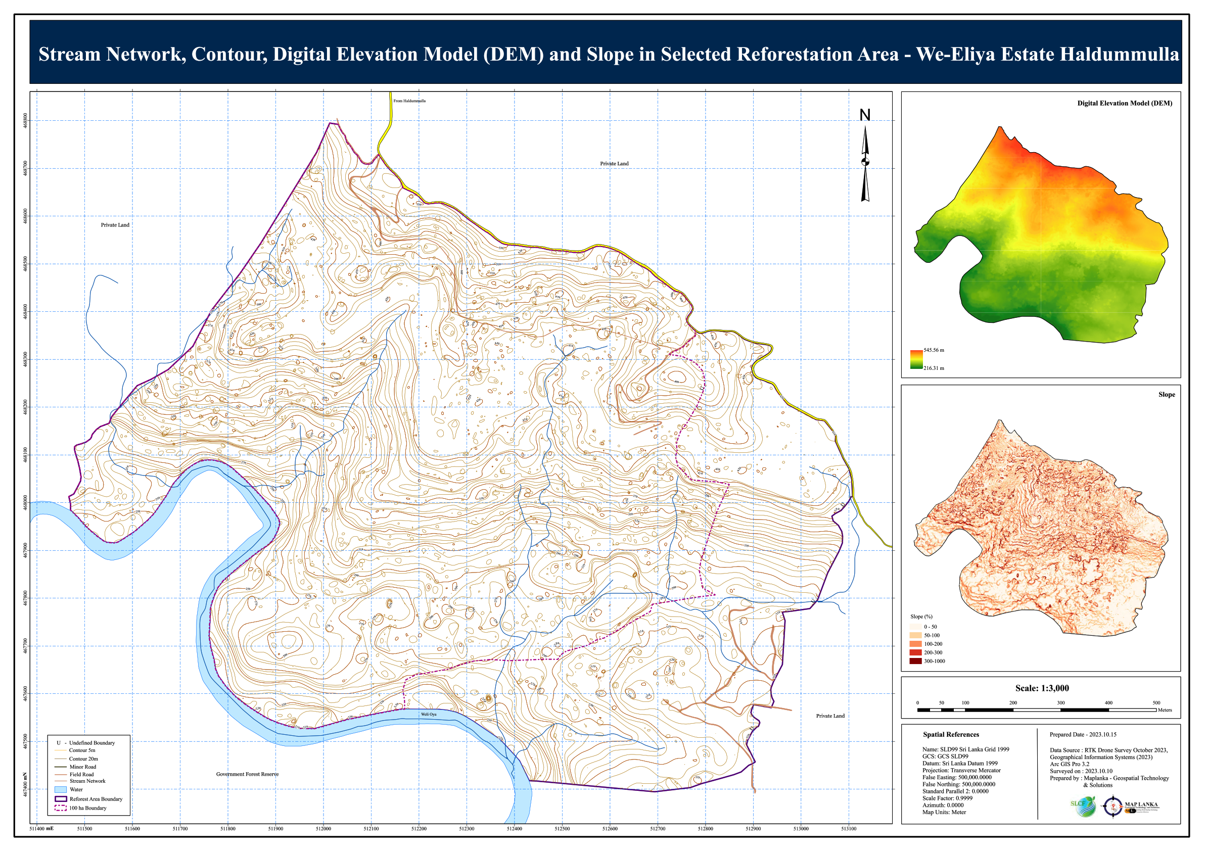
Map Lanka is a leading Geospatial technology and solution provider for the Sri Lanka. We are creating highly precise output for the client The more accurate and precise the data, the higher cost to obtain and store it because it can be very difficult to obtain and will require larger data files. For example, a 1-meter-resolution aerial photograph will cost more to collect (increased equipment resolution) and cost more to store (greater pixel volume) than a 30-meter-resolution aerial photograph.
Highly precise data does not necessarily correlate to highly accurate data nor does highly accurate data imply high precision data. They are two separate and distinct measurements. Relative accuracy and precision, and the inherent error of both precision and accuracy of GIS data determine data quality.
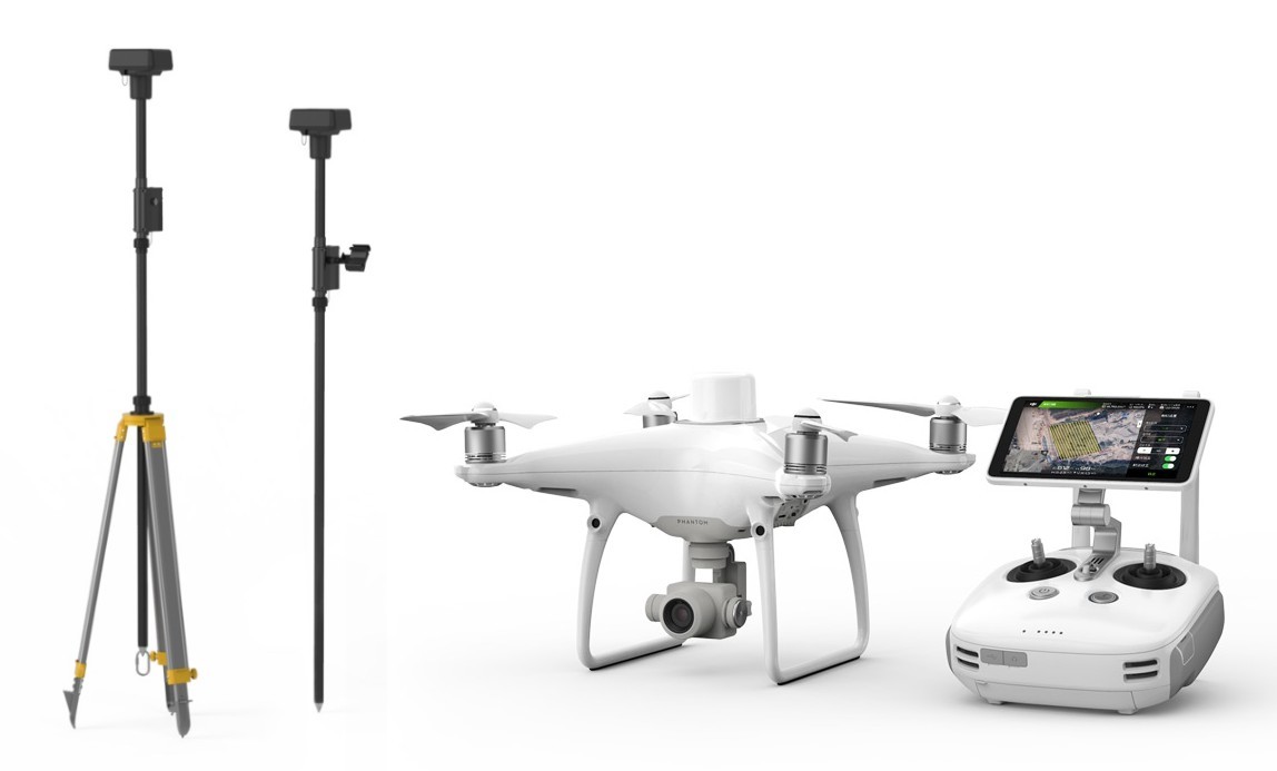
CENTIMETER-LEVEL POSITIONING SYSTEM
We have Phantom 4 RTK Quadcopter from DJI that is designed to deliver centimeter-level accurate mapping that can be extremely useful for surveying, construction sites, and inspections. Utilizing an RTK receiver on the top of Phantom 4, the Phantom 4 RTK can achieve 1cm+1ppm RTK horizontal and 1.5cm+1ppm RTK vertical positioning accuracy.
VERY HIGH RESOLUTION IMAGES
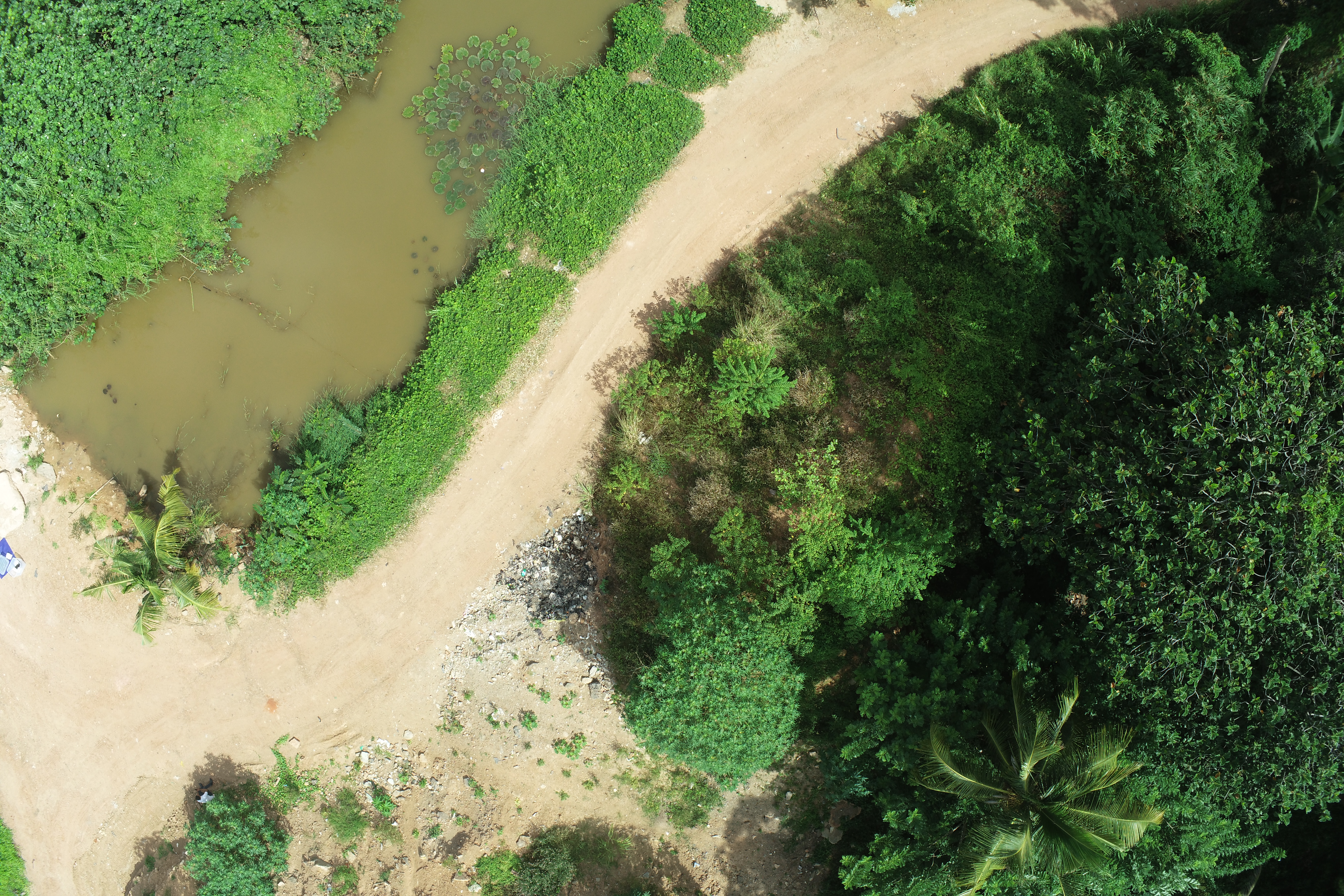
Get extremely detailed orthomosaic maps and high resolution aerial imagery of large areas.
We undertake photogrammetry services utilizing specialized aerial photography UAV’s. All of our photogrammetry UAV’s are equipped for high precision RTK/PPK GNSS processing. Using high resolution aerial photographs, we can generate a range of products including classified point cloud, digital terrain model, digital surface model, and high resolution GNSS located orthophotography. We have a range of various sized RTK/PPK photogrammetry UAV’s suitable for all survey sizes.
OUR OBJECTIVES
For millennia, maps have held talismanic powers, helping to form spatial concepts and advance exploration. They have shaped geopolitical ideas, triggered international disputes and created pictures of the world both large and detailed.
Today, satellites and digital mapping tools have turned modern cartography — the science and art of map-making — into a technology-driven field. With accuracy all but guaranteed, new ways of visualizing space have emerged in the process. They mix art, experience and topography, approaching the physical world through the lens of time, perspective and storytelling.
“We’re approaching geographical environments from different directions, and (finding) ways of presenting geospatial locations that aren’t maps in the traditional sense, but rather map-like visualizations. It’s no longer just about a spatial display, although that remains the main reference point for any cartographer. Maps are getting smarter, and showing us the world under different parameters.”
The development of a country can only take place if there is a more formal planning process. Our main objective is to establish the necessary technical services in the country. Our main tasks are to improve the human resources required to introduce more accurate technology instead of the traditional mapping process and to develop accurate and up-to-date information systems for decision making and knowledge creation. We are providing most effective service for you to get your job done. Applications in the Geographic Information System in Sri Lanka are limited to the study process. We are always at the forefront of providing you with the most advanced and efficient methodology currently available in the world. With over 20 years of professional experience, we are a team with the potential to take our Sri Lankan identity and knowledge to the world, providing the most reliable services with applications in multiple fields